Subscribe to our e-newsletter!
If you are looking for Hungarian events, great recipes, cultural connections, and encouragement as you celebrate your Hungarian heritage, we are here to help! We will never share or sell your data.

$70.00
Shipping on this product is included!
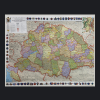
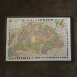
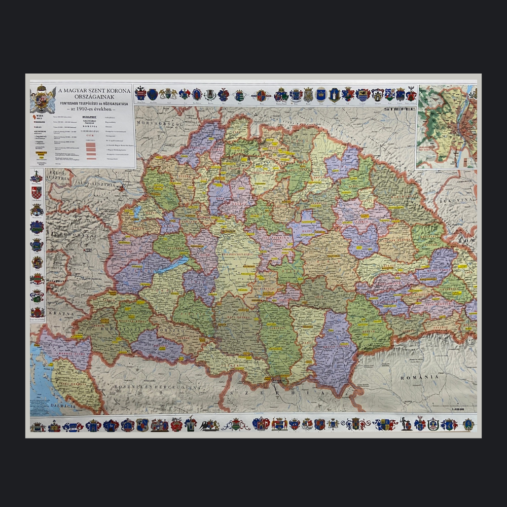
This full color circa 1910 Laminated Map of Hungary and county crests around the edges. This large map is approximately 27.5″ x 40″ and contains many small towns and villages as well as all the old county boundaries (megye – county). Everything outside of the current borderline of Hungary is listed with its Hungarian name as this is a map from that time frame.
This is a wonderful item for classroom teaching, genealogists, Hungarian history buffs, and Hungarian clubs. It’s perfect for den or office!
Map size 27.5″ x 40″ and ships separately.
This map does not have the outline of the current border of Hungary on it. This is a map of the Austro-Hungarian empire as it was.

Accessories
Accessories
Accessories
Accessories
Accessories
Accessories
Accessories
Accessories
Accessories